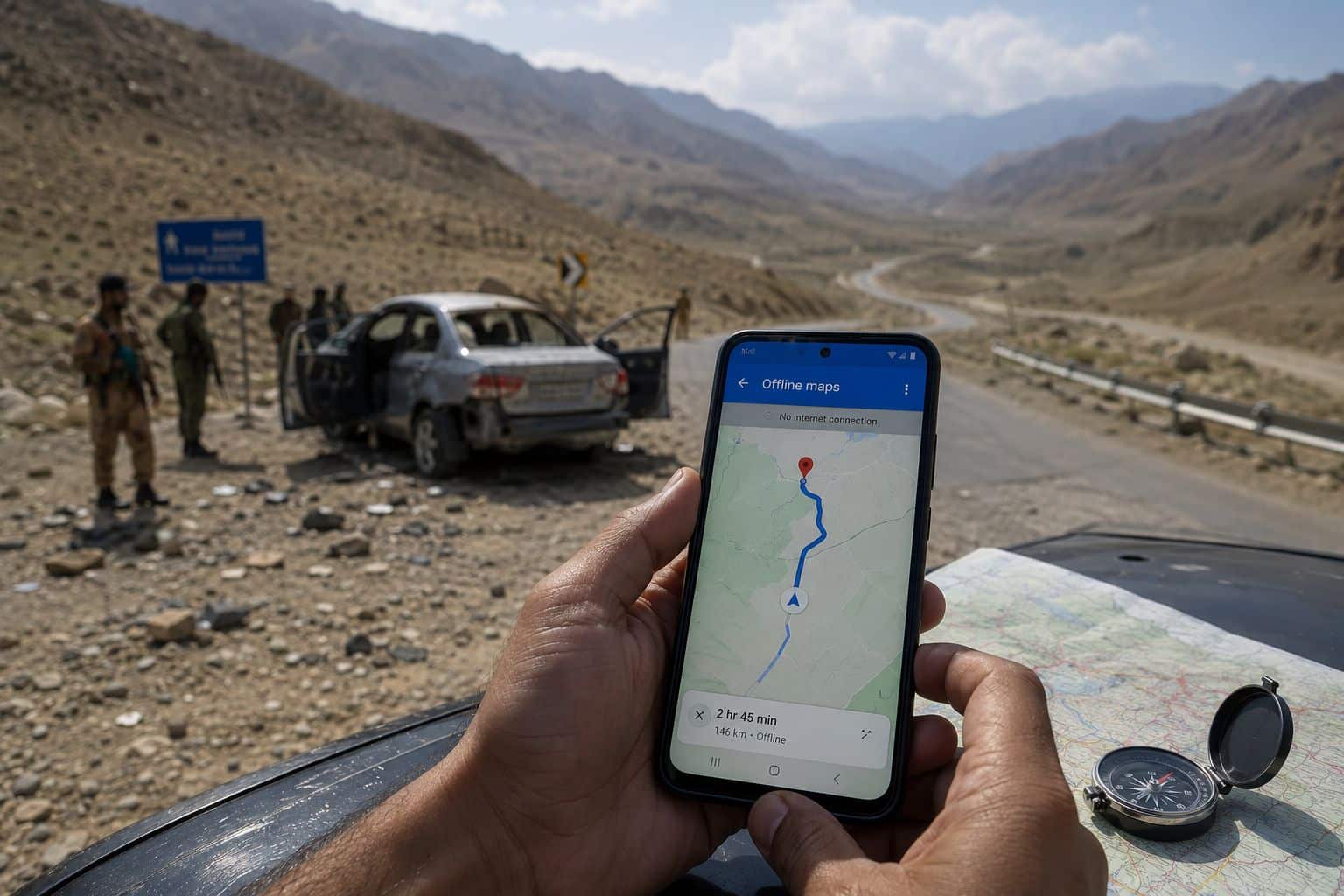
ISLAMABAD: A deadly attack on a tourist vehicle in Balochistan province, which left one man dead and his wife critically injured, has reignited debate over the safety and reliability of Google Maps in remote and conflict-prone regions.
The incident prompted widespread criticism of Google Maps on social media, with many users questioning whether the navigation platform directed the victims onto a dangerous route. However, mapping experts argue that attributing the tragedy solely to the application oversimplifies a far more complex issue.
Kashif Maseedia, a Google Maps Local Guide and contributor in Pakistan, said the attack should be viewed as an exceptional tragedy rather than a failure of the navigation service itself.
“Google Maps is designed to provide navigation based on satellite imagery, GPS data and information contributed by users,” he explained. “Its performance can vary significantly in remote or inaccessible areas where mapping data is limited.”
According to Maseedia, urban centers such as Karachi benefit from continuous updates by thousands of users who regularly add and verify roads, businesses and other locations. This extensive community input makes maps in major cities relatively accurate and comprehensive.
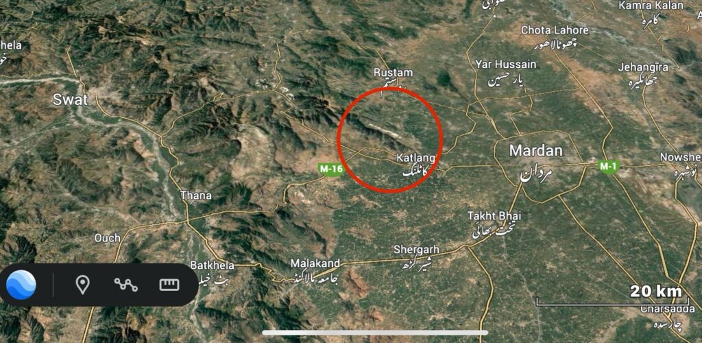
By contrast, many parts of Balochistan and other remote regions of Pakistan remain under-mapped because public access is limited, making it difficult for contributors to verify or update local information.
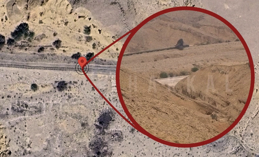
He noted that Google Maps may even identify frequently traveled tracks as potential roads if enough users repeatedly traverse the same path with GPS enabled.
“However, the platform has no capability to determine whether a route is safe or unsafe from a security perspective,” he said.
Maseedia emphasized that mapping of many remote areas in Pakistan, particularly in Balochistan, remains a work in progress. While navigation in urban areas has reached a high level of accuracy, rural, sparsely populated and mountainous regions continue to present significant challenges.
He also highlighted the importance of downloading offline maps before undertaking long journeys.
“If users have offline maps saved on their devices, Google Maps can continue providing navigation through GPS even when mobile internet service is unavailable,” he said, adding that he has personally relied on the feature during trips through areas with poor connectivity.
However, he cautioned that if both GPS reception and mobile signals are disrupted, the performance of any navigation application will inevitably deteriorate.
Addressing calls for Google Maps to flag dangerous locations, Maseedia said neither ordinary users nor volunteer contributors have the authority to designate areas as security threats.
“Identifying dangerous locations and warning the public is the responsibility of the relevant government authorities,” he said. “Authorities should install warning signs and implement appropriate security measures where necessary.”
He pointed out that Google Maps does allow users to report traffic accidents, road closures, potholes, traffic congestion and other hazards, enabling other motorists to receive real-time updates. Security threats, however, fall outside the platform’s standard reporting system.
Maseedia said users often assume Google Maps is malfunctioning when the actual problem stems from weak internet connectivity, poor GPS signals or changing traffic conditions. He also noted that the application displays vehicle speed, allowing drivers to compare it with their vehicle’s speedometer.
In large cities such as Karachi, Google Maps frequently recommends alternative streets and shortcuts to reduce travel time. While these routes can be useful, Maseedia stressed that drivers should not follow navigation instructions blindly.
“The purpose of Google Maps is to optimize travel time and distance, not to assess security conditions or local risks,” he said. “Users must always rely on their own judgment and consider the situation on the ground.”
He cited the example of nighttime travel, advising motorists to reconsider following navigation directions if they lead through isolated forests or unfamiliar roads.
Comparing Pakistan with neighboring countries, Maseedia said the country has significantly fewer Google Maps contributors than nations such as Bangladesh, resulting in slower updates and less comprehensive mapping in many areas.
Despite these limitations, he estimated that Google Maps provides accurate navigation in urban Pakistan approximately 95% of the time, with most remaining issues linked to connectivity, GPS limitations, incomplete mapping or changing local conditions.
Concluding his remarks, Maseedia urged travelers to treat Google Maps as a valuable navigation aid rather than an infallible guide.
“When traveling through remote, sparsely populated or security-sensitive areas, download offline maps in advance, seek guidance from local residents whenever possible, and make decisions based on real-world conditions rather than relying exclusively on any navigation app,” he said.